Petaluma River
5. . . . and Yon
Up and Down the Bay
Having thoroughly explored the South Bay we started to venture further afield. There were numerous excursions to destinations such as San Francisco, Sausalito, Angel Island, Yerba Buena Cove, and one memorable trip up the Petaluma River.

The GAMBELLA as Seen From Angel Is

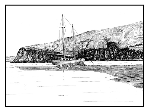
On The Petaluma River

Uncle Rob in His Pulpit
(click on image for larger view)

Catching Rays

Deeds as Figurehead
![]()
And Out the Gate
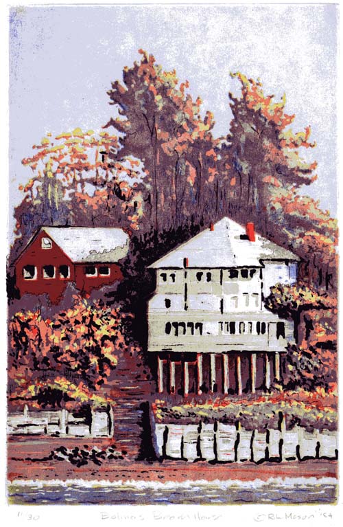
Eventually, we left the Bay entirely, usually proceeding north along the coast to destinations such as Bolinas Bay and Drake’s Bay. Each trip found us going further afield. We rounded Pt. Reyes and ended up in Bodega Harbor with
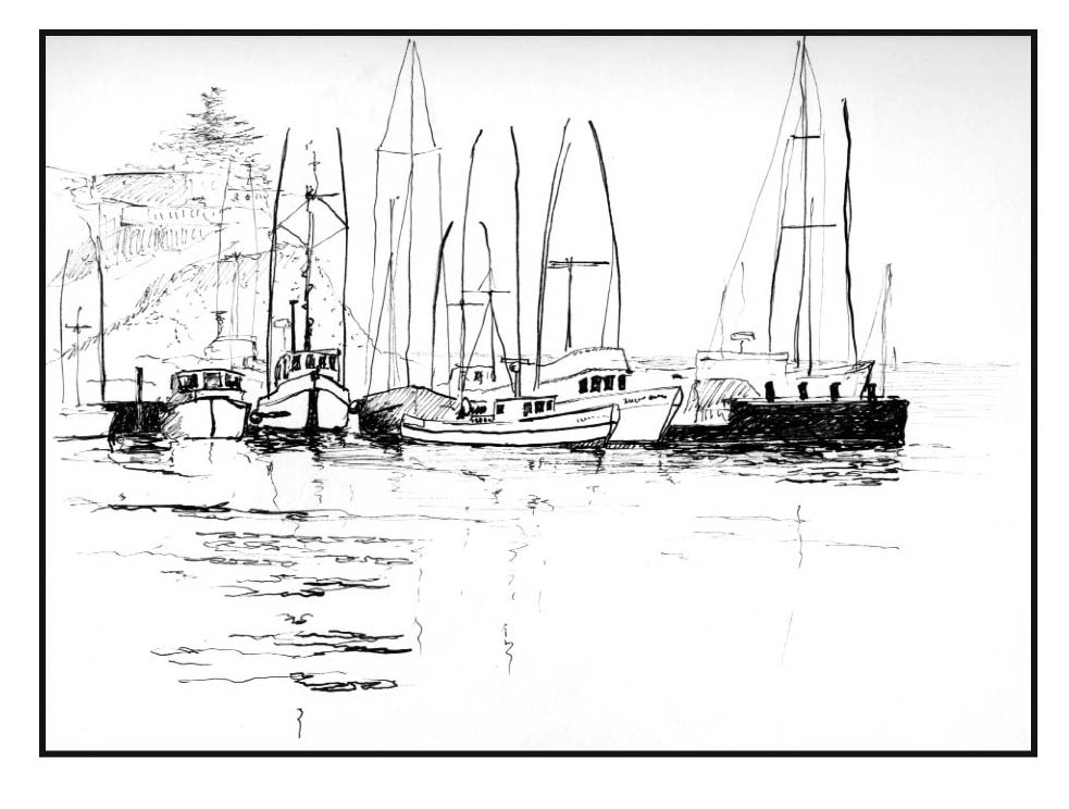
its substantial commercial fishing fleet. But our favorite destination was Tomales Bay which is directly south across Bodega Bay from Bodega Harbor. The distance is about ten miles.

Anchored in Bolinas Bay

Rounding Point Reyes

Points of Interest: (click on image for larger view)
(1) San Francisco

Outside the Golden Gate
(2) Angel Island
(3) Sausalito
(4) Bolinas Bay (also click here)
(5) Drake’s Bay
(6) Point Reyes
(7) The Farallon Islands
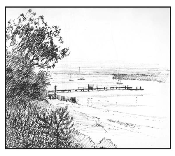
The best time to enter Tomales Bay is in the morning at high tide before the wind picks up. The entrance is fairly shallow and sometimes the combination of an ebb tide and the Northwest wind can made it extremely rough. The Bay itself is long and narrow and it has this shape because it sits right on top of, and is formed by, the San Andreas Fault. At the foot of the Bay is Inverness where you can pick up groceries, gas etc. On the east shore, at about the half way point, is the town Marshall which has a boat works should you need one. Approximately across from Marshall and a little to the north is White Gulch — my favorite anchorage.

Gone for a Hike

The Boat Works at Marshall

Anchored at White Gulch
(click on image for larger view)

North of Point Reyes
Points of Interest:
(1) Bodega Harbor
(2) Marshall (also click here)
(3) Inverness (also click here)
(4) White Gulch (also click here)
The winds for sailing on Tomales Bay are rather flukey. They change every time you pass by a low gap in the Tomales Peninsula, but the scenery is superb. The resident human population is very low and the surroundings are primarily bucolic. On the peninsula there is a population of elk.
The Farallon Islands
On two occasions I visited the Farallon Islands. The largest island has an anchorage on the north side called Fisherman’s Cove. It is only big enough for one boat (maybe two) to swing at anchor and is only an alternative in fairly calm weather. The bottom of the cove is composed of large boulders and crevasses, and I had heard it was a very easy place to lose an anchor. I stopped there once for an overnight on a return trip from the Bodega area, and I didn’t get much sleep. Immediately upon arriving, the boat was covered with a swarm of flies. Fortunately, I had a can of bug spray to discourage them, but I had to use the whole can. The cove is surrounded by lounging sea lions and at the slightest disturbance there would arise rounds and rounds of barking. There is usually a naturalist stationed on the island, and I could see one watching my every move when I arrived, but since I made no attempt to go ashore, which is prohibited, he eventually lost interest. That occasion and the following day turned out to be a very wet trip, so the only photos I have are water damaged, but here they are for what they are worth:

The Farallon Light
(click on image for larger view)

Fisherman's Cove
Categories
- THE GALLERY
- Uncle Rob's Art
- 3D Works (stills) I
- 3D Works (stills) II
- 3D Works (stills) III
- 3D Works (video)
- Design & Abstract I
- Design & Abstract II
- Design & Abstract III
- Figurative Works I
- Figurative Works II
- Landscapes I
- Landscapes II
- Largest Art Project
- Nautical and Marine Images (video)
- Nautical and Marine Images I
- Nautical and Marine Images II
- Nautical and Marine Images III
- Nautical and Marine Images IV
- Portraits
- Still Life Images
- Stump Hollow Photo Essay I
- Stump Hollow Photo Essay II
- Uncle Rob's Mendocino Shop
- The Five Sense Series
- Irene's Creations
- Works by Don Mason
- Works by Don Mason II
- Works by Joseph de Borde
- Painting by Albert Robbins
- Art by Leslie Masters Villani
- Paintings by Nellie Harriet Parker
- The Art of Bee Yearian
- Works by Evie Wilson
- Uncle Rob's Art
- SCHOONER MOON BOOKS
- SEA STORIES
- ONE DOZEN AND TWO ESSAYS
- Cousinhood
- Art by Definition
- Cake Mixed Economy
- Marriage Anyone?
- Sex and/or Violence
- Searching for Truth
- The Philosophical Roots of Science
- Stepping Stones and Stumbling Blocks
- On Being Good
- Teaching By Example
- The Basic Law of Civilization
- Where Goeth Evil?
- A Modern Empircal "Religion"
- Knowledge as Wealth
- PAPERS AND ARTICLES
- FAMILY STORIES
- BOOK REVIEWS
Archive
- December 2021
- October 2020
- June 2020
- September 2019
- July 2017
- March 2017
- December 2016
- November 2016
- October 2016
- August 2016
- July 2016
- June 2016
- May 2016
- March 2016
- February 2016
- February 2015
- January 2015
- February 2014
- December 2013
- November 2013
- August 2013
- June 2013
- August 2012
- July 2012
- April 2012
- March 2012
- February 2012
- November 2011
- September 2011
- June 2011
- May 2011
- April 2011
- March 2011
- February 2011
- January 2011
- December 2010
- November 2010
- October 2010
- September 2010
- August 2010
- July 2010
- June 2010
- May 2010
- April 2010
- March 2010
- February 2010
- January 2010
- December 2009
- November 2009
- October 2009
- September 2009
- August 2009
- July 2009
- June 2009
- May 2009
- April 2009
- March 2009
- February 2009
- January 2009
- December 2008
- November 2008
- October 2008
- September 2008