4. Thither . . .
DD 305
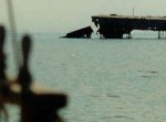
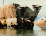
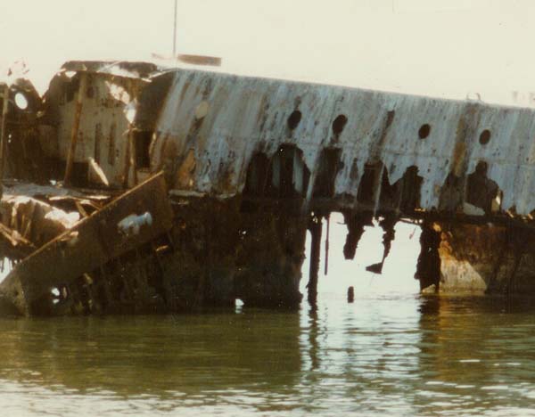
Here is a sight in the South San Francisco Bay that can only be seen up close by boat. It is about three miles north of the Dumbarton Bridge on the east side of the Bay. It is almost directly east of the entrance to the Port of Redwood City. These photos are 35 to 40 years old so maybe not as much can be seen today:
(click on image for larger view)
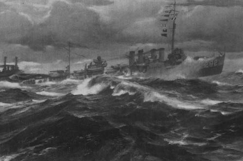
What is seen is what remains of the USS Thompson (DD 305). She has been at this location since 1944, and is the last of the “Four Pipers.” She was commissioned at the Mare Island Navy Yard in August 1920, a little late for an active part in WWI. She was one of 273 flush-deck destroyers commissioned between 1917 and 1922. By WWII they were approaching obsolescence but still managed to play a role in that conflict. The Thompson was sold in June of 1931 and at one point served as a bar in South San Francisco, but during WWII she was scuttled at her present location and used as a target for pilots training at nearby Moffett Field Naval Air Station.
Here is a depiction of what she would have looked like in action:
Drawbridge
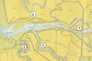
In the previous post I mentioned points of interest that can be seen by sailing south from Palo Alto, but there is one more in that direction that should be noted that is of historical significance. It is called Drawbridge and is located about as far as one can go by boat at the south end of San Francisco Bay. Today it is a ghost town but in the 1920s it was a thriving little village. The chart below shows it’s location (9):
(click on image for larger view)
Points of Interest:
(4) Guadalupe Slough
(6) Alviso Slough
(8) Abandoned Duck Club up Mowry Slough
(9) Drawbridge
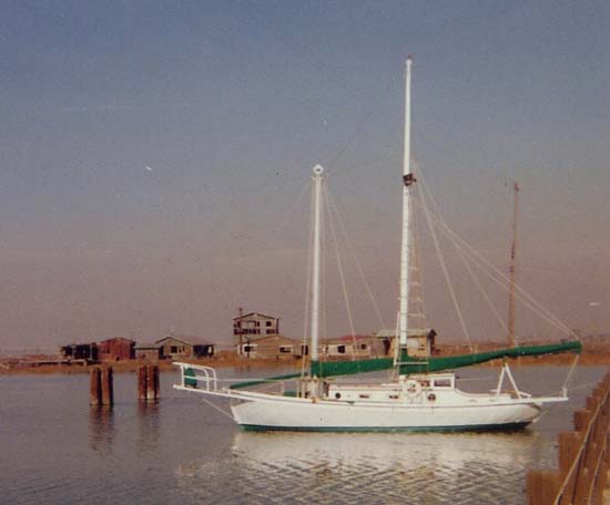
The history of Drawbridge starts with the building of a railroad line across Station Island in about 1876. Station Island is formed by Warm Springs Slough (now called Mud Slough) on the north side and Coyote Slough (0r Creek) on the south side. Both of these waterways were navigable and thus required by federal law to remain open. Consequently, the railroad had to provide a drawbridge at each slough and hire someone to operate them. This was done, and somewhere in the mid 1870s a shack was built to house the drawbridge operator. Word spread that the area was excellent for duck hunting and fishing. Soon, other shacks were built along the railroad tracks and a whole village sprang into existence. During prohibition the “town” was very popular because the only way to get to it was by boat or railroad, a fact which insulated it from local law enforcement. To this day access is still quite limited. You can hike out along the railroad tracks north from Alviso for about two miles or arrive by boat. Below is a photo of the GAMBELLA moored Mediterranean style to the railroad trestle in about 1980:
No comments yet.
Leave a comment
Categories
- THE GALLERY
- Uncle Rob's Art
- 3D Works (stills) I
- 3D Works (stills) II
- 3D Works (stills) III
- 3D Works (video)
- Design & Abstract I
- Design & Abstract II
- Design & Abstract III
- Figurative Works I
- Figurative Works II
- Landscapes I
- Landscapes II
- Largest Art Project
- Nautical and Marine Images (video)
- Nautical and Marine Images I
- Nautical and Marine Images II
- Nautical and Marine Images III
- Nautical and Marine Images IV
- Portraits
- Still Life Images
- Stump Hollow Photo Essay I
- Stump Hollow Photo Essay II
- Uncle Rob's Mendocino Shop
- The Five Sense Series
- Irene's Creations
- Works by Don Mason
- Works by Don Mason II
- Works by Joseph de Borde
- Painting by Albert Robbins
- Art by Leslie Masters Villani
- Paintings by Nellie Harriet Parker
- The Art of Bee Yearian
- Works by Evie Wilson
- Uncle Rob's Art
- SCHOONER MOON BOOKS
- SEA STORIES
- ONE DOZEN AND TWO ESSAYS
- Cousinhood
- Art by Definition
- Cake Mixed Economy
- Marriage Anyone?
- Sex and/or Violence
- Searching for Truth
- The Philosophical Roots of Science
- Stepping Stones and Stumbling Blocks
- On Being Good
- Teaching By Example
- The Basic Law of Civilization
- Where Goeth Evil?
- A Modern Empircal "Religion"
- Knowledge as Wealth
- PAPERS AND ARTICLES
- FAMILY STORIES
- BOOK REVIEWS
Archive
- December 2021
- October 2020
- June 2020
- September 2019
- July 2017
- March 2017
- December 2016
- November 2016
- October 2016
- August 2016
- July 2016
- June 2016
- May 2016
- March 2016
- February 2016
- February 2015
- January 2015
- February 2014
- December 2013
- November 2013
- August 2013
- June 2013
- August 2012
- July 2012
- April 2012
- March 2012
- February 2012
- November 2011
- September 2011
- June 2011
- May 2011
- April 2011
- March 2011
- February 2011
- January 2011
- December 2010
- November 2010
- October 2010
- September 2010
- August 2010
- July 2010
- June 2010
- May 2010
- April 2010
- March 2010
- February 2010
- January 2010
- December 2009
- November 2009
- October 2009
- September 2009
- August 2009
- July 2009
- June 2009
- May 2009
- April 2009
- March 2009
- February 2009
- January 2009
- December 2008
- November 2008
- October 2008
- September 2008
